On Thursday afternoon I found a website that has satellite pictures of the hurricane damage but I was having trouble getting it to work on my computer. Earlier this morning, I stumbled across the
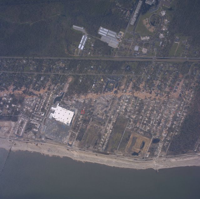
site again and it worked. I quickly checked Google maps so that I could find the general vicinity of Roxi's grandparents' camp and tried a block of the map. Bingo! Although my excitement quickly passed as I confirmed what I have been expecting since Monday afternoon. There is nothing left of the Camp but the foundation. Below is the satellite photo with the slab of what I believe to be the Camp circled in red. The large white structure to the southwest of the Camp is the Super Wal-mart. A high-resolution version of the image below can be found
here.

The photo below is a zoomed in picture of the former site of the Camp. As you can see from the picture, the line of timber and debris representing the end of the storm surge stops just a few houses to the north of the camp. Unfortunately the camp was not far enough down the road to avoid complete and total destruction.

Incidentally, the picture that I use for my profile shot was taken on the beach directly across the street from the Super Wal-mart.


1 comment:
Wes,
I'm curious. What are your thoughts on the speed with which the state of Florida has received hurricane aid recently vs. that of New Orleans?
-nitin
Post a Comment